 Hanham, South Gloucestershire
 National and local planning policy – including the emerging South Gloucestershire Local Plan – require better use to be made of available, previously developed ‘brownfield’ land. The Anstey’s Road site is brownfield land, measuring just under 6 acres, and it has been vacant for many years. It is well-located with key facilities and amenities nearby, including Hanham High Street.
Adjacent to the west is Sealtech’s service yard. Homes England have applied for a new access to the yard from New Walk, which will allow for a more efficient use of the available space and a better layout. The submitted documentation can be viewed on South Gloucestershire Council’s website under planning application reference P20/21981/F. The application has been approved and works are expected to start in autumn 2021.
The site has been quarried and mined for coal in the past and in order to make it suitable for redevelopment, enabling groundworks are required such as grouting. The works will be carried out over the course of a few months and are expected to finish in Spring 2022. The site’s nearest neighbours have been informed.
Please have a look at the drone images, which were taken from six different points above the site. The site boundary is indicated with a red line.
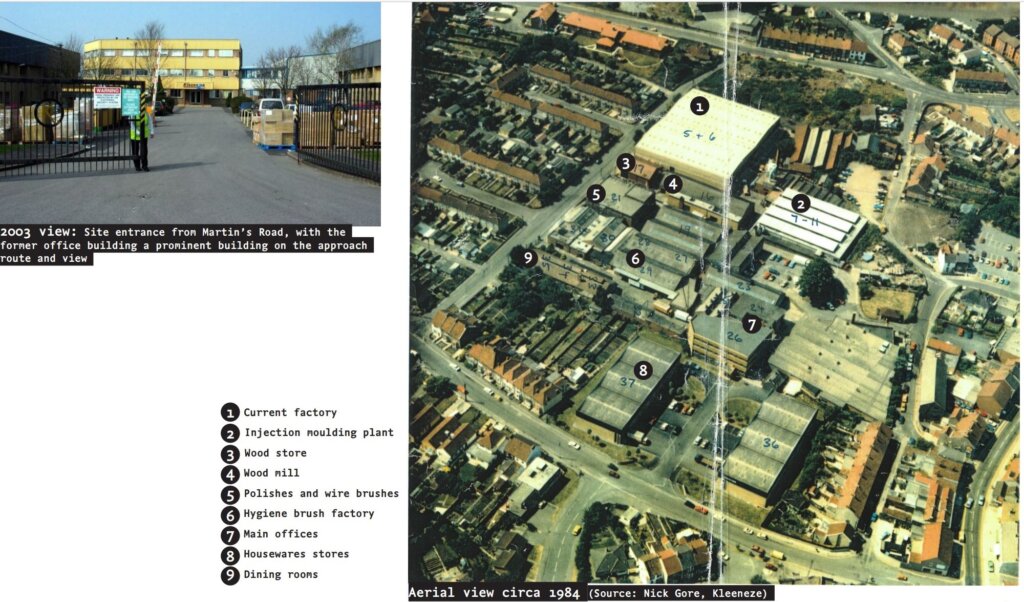
The site has been a central part of Hanham for decades and it has a rich history. Please see below an image of the site as it was in 1984, providing an overview of the buildings that used to be on-site, and a picture of the front entrance as it was in 2003.
Site Location
This map shows you the boundary for the Anstey’s Road site. Click and drag the map in the direction you want to move it to see where local places of interest are in relation to the site. This map is for illustrative purposes only.


